Raster Style Pages
When the Style Editor dialog is opened on a raster layer the following pages are available.
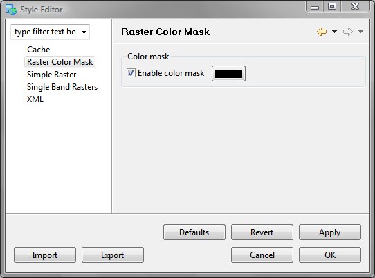
Raster Color Mask
The Raster Color Mask makes a single color of a coverage transparent. Often used in satellite images to indicate areas where no information was recorded.
Related tasks
Simple Raster
Allows simple control over the rendering of a raster image.
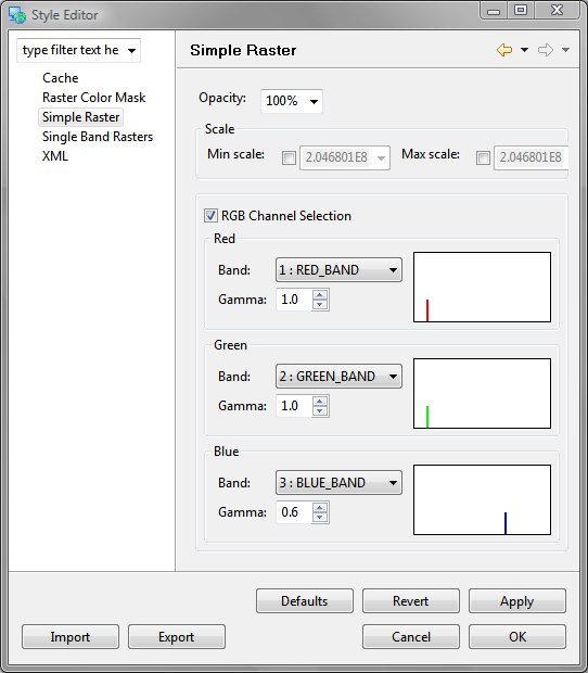
Opacity: allows the transparency of an image to be set; often useful to allow artificial boundaries to show through the raster.
Scale: Control the scale at which the raster is shown
RGB Channel Selection
Provides control over mapping raster channels to Red, Green and Blue channels for display. The gamma of each band can be controlled allowing you to adjust how much of a contribution each band makes to the final display.
- Band: Allow the selection of a data band. Most processed images are already defied in terms of Red, Green and Blue. If you are working with raw satellite information you will need to carefully select the correct radar, visual light or infrared band for the analysis being performed.
- Gamma: Allows fine grain control over the contribution being made.
- 0-1: Multiplies the contribution; brightening the channel accordingly
- 1.0: Direct 1 to 1 ratio
- 1-*: Minimises the contribution; dimming the channel accordingly
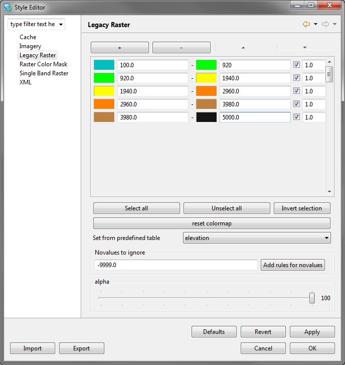
Legacy Raster
Used to handle single band rasters (such as digital elevation models) where you can map value ranges to artificial colours for display. A number of predefined color maps are provided.
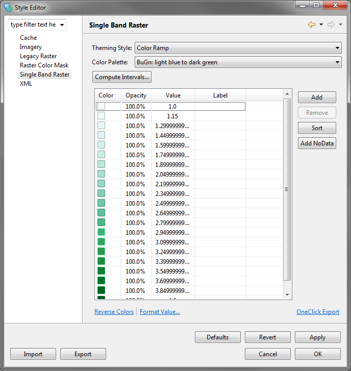
Single Band Raster
An updated interface fo styling single band rasters (ex. digital elevation models). Users can generate color themes for their rasters using predefined theme types and color palettes. This interface also provides tools for generating breaks based on values from the raster. Generated values and colors can be manually modified if required.